Home
GIS Solutions Articles
PDH
GIS Editorial
Esri Press Releases
GISCI Announces Captain Amilynn Adams, GISP®, Elected as Second GISP®-Elected Board Director
The Intelligent Landscape: How AI Is Broadening the Reach of Geospatial Intelligence
GEO Business 2026 breaks attendance records with 6,200+ professionals
Esri’s Jack Dangermond Honored with Award from International Fund for China’s Environment
Advisory Board Announced for Geo Week 2027
Previous
Next
GIS Solutions Articles
See All Content
GIS Solutions: CUC, GHD and Esri Achieve Water Utility Excellence on the Mariana Islands
The Northern Mariana Islands, located just north of Guam in the western Pacific Ocean, offer both beauty and technical obstacles, especially in the pursuit of sustainable and reliable water service. Its remote location, legacy of wartime damage and exposure to frequent typhoons present ongoing chall...
GIS Solutions: Montana State University’s Digital Transformation
With infrastructure including 17-plus miles of water mains, 10 miles of gravity sewer and a complex web of stormwater, electric and natural-gas systems, Montana State University (MSU) in Bozeman, Mont., is amongst the top universities in the management of its own utility services. This unique positi...
GIS Solutions: Denver International Airport Manages a Big Property with a Small Team
Denver International Airport (DEN) can be described in many ways, including the following:• It’s the largest airport in the western hemisphere by land area, and the second largest on Earth. One of DEN’s six runways, 16R/34L is, at 3.03 miles, the longest public-use runway in North America.• It’s the...
GIS Solutions: Portcoast’s BIM and 3D GIS Expertise Is Remaking Vietnam
Building Information Modeling (BIM), 3D GIS and reality capture are now well-established technologies, especially considering the rapid pace of digital transformation in the 21st century. It’s no surprise that even a modestly sized consulting !rm such as Vietnam’s Portcoast (220 employees) can lever...
GIS Solutions: SRF Consulting Saves Lives with Innovative GIS Transportation Solutions
In 2009, in what was described as a “first of its kind effort,” the Minnesota Department of Transportation (MnDOT) led the way in developing County Road Safety Plans (CRSPs) for all of its 87 counties.
Small Ohio City Uses ArcGIS ‘Out of the Box’ Solutions to Proactively Manage Stormwater Infrastructure and Permitting
GIS Solutions: Monroe, Ohio, is a city of modest size (population 15,412) in the Cincinnati metro area; as such, stormwater services operate according to Ohio’s “Small Municipal Separate Storm Sewer Systems (MS4s) - General Permit.”
GIS Solutions: One Standard to Rule Them
OHLA Adopts IFC for Interoperability in Large Spanish Roadway ConstructionThe Spanish multinational construction and civil engineering company Obrascón Huarte Lain, S.A. (branded as OHLA Progress Enablers since July 2021) has begun construction work on the Malpartida bypass road in the province of C...
GIS Solutions: Digital Innovation: HNTB’s Reality Mapping Evolution
For more than a century, employee-owned design firm HNTB has helped create built-world projects that meets the unique demands of its environment and community. With client relationships spanning decades, they understand infrastructure life cycles and have the perspective to solve technical challenge...
GIS Solutions: 1898 & Co. Applies Cutting Edge Engineering to Digital Infrastructure
1898 & Co., part of Burns & McDonnell, that is celebrating its 125th anniversary of the firm's founding, is a globalbusiness and technology consultancy. 1898 & Co. is a blendof engineers and industry specialists who bring togetherbusiness insights with leading technical capabilities. WhileBurns & Mc...
See All Content
GIS Editorial
See All Content
Change Leader: GIS and Digital Twins Change How a Massive Airport Manages Its Assets
Adan Banda and Brandon Mann This interview was recorded by Todd Danielson, the editorial director of Informed Infrastructure. You can listen to the full interview by visiting iimag.link/DBTFe. Adan Ba...
Podcast with Christa Campbell, Director of Water Industry Solutions at Esri
Todd Danielson, Informed Infrastructure’s editorial director, interviewed Christa Campbell, Director of Water Industry Solutions at Esri.They discussed how water utilities that manage critical infrast...
Why 2026 is Crucial for Telcos to Rethink Their Geospatial and Network Stacks
Telecommunications operators are entering into one of the most consequential periods of transformation the industry has seen in decades. Across global markets, telcos are expanding 5G, accelerating fi...
Mapping the Future of Connectivity: How GIS is Solving Telecom Infrastructure Challenges
Written by Buddie Ceronie, Global GM for Telecommunications, VertiGIS In an era when location information holds immense value, geospatial data empowers telecom companies with...
Change Leader: How Utilities Can Improve GIS Migration by Rethinking Design Data Management
As utilities modernize their GIS platforms, one question continues to challenge even the most experienced teams: how should network design data be managed during platform migration? Traditionally, ...
Podcast with Johnny McGlone, GIS Manager, Digital Solutions, STV Inc.
Todd Danielson, Informed Infrastructure’s editorial director, interviewed Johnny McGlone, GIS Manager, Digital Solutions, STV Inc. They discussed a project McGlone and his team presented at the re...
Podcast with Esri's Director of AEC Industry Solutions, Marc Goldman
Todd Danielson, Informed Infrastructure’s editorial director, interviewed Marc Goldman, Esri's Director of AEC Industry Solutions.They discussed the recent Esri IMGIS conference in Palm Springs, Calif., and some of the noteworthy project presentations at the event, including utility-scale GIS implem...
Podcast from Esri UC 2025: Raj Ubhi, Geospatial Analyst at Arup
Todd Danielson, Informed Infrastructure’s editorial director, interviewed Raj Ubhi, Geospatial Analyst at Arup. They discussed how Arup’s digital team collaborates with subject matter experts (SMEs) and clients to solve challenges using a suite of applications based on ArcGIS infrastructure. Ubhi go...
Podcast from Esri UC 2025: DFW International Airport Embraces Digital Model
Todd Danielson, Informed Infrastructure’s editorial director, interviewed Adan Banda, Senior Geospatial Data Manager at DFW Airport, and Brandon Mann, Geospatial Analyst at DFW Airport.They discussed how DFW International airport uses digital models to advance asset data collection, real-time visual...
Esri Press Releases
See All Content
GISCI Announces Captain Amilynn Adams, GISP®, Elected as Second GISP®-Elected Board Director
Des Plaines, IL – (June 25, 2026)The GIS Certification Institute (GISCI) is pleased to announce that Captain Amilynn E. Adams, GISP®, has been elected as the second GISP®-Elected Director on the GISCI...
The Intelligent Landscape: How AI Is Broadening the Reach of Geospatial Intelligence
By Dan GruidelGeospatial data has never been more abundant or more essential. From climate resilience and emergency response to infrastructure planning and utility management, organizations depend on ...
GEO Business 2026 breaks attendance records with 6,200+ professionals
Over 6,200 professionals headed to GEO Business 2026, cementing its position as the UK's leading event for geospatial technology and location intelligence.Held at Excel London on 3–4 June, the ev...
Esri’s Jack Dangermond Honored with Award from International Fund for China’s Environment
Esri president Jack Dangermond received the 30 Years of International Green Development Influential Figures Award from the International Fund for China’s Environment (IFCE).IFCE is a major internation...
Advisory Board Announced for Geo Week 2027
Leading geospatial and mapping event selects industry leaders to help deliver critical insights to geospatial professionalsSalt Lake City, Utah, USA, June 4, 2026 – Organizers of Geo Week, the premier...
WGIC and University Partners Announce World's First Professional Doctorate in Geospatial Leadership
Developed in partnership with WGIC and its 50+ member organizations, Clark University and the University of Southern California will each offer the Executive Doctor of Geospatial Leadership (DGEO) pro...
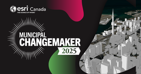
Esri Canada named a Municipal Changemaker by Municipal World
Key pointsEsri Canada was named a Municipal Changemaker by Municipal World for helping municipalities across Canada use GIS and location intelligence to improve decision making.Municipalities use GIS ...
What's New in ArcGIS Web Editor in ArcGIS Enterprise 12.1
By Albert Schelin and Martin CoppingArcGIS Web Editor is a lightweight and user-friendly editing app built for both GIS Professionals and occasional editors. This focused app is dedicated to editing, ...
Esri Recognizes Partners for Innovation, Excellence, and Long-Standing Contributions to the Geospatial Community
Awards Granted for Exceptional Achievement Using GIS at 2026 Esri Partner ConferenceREDLANDS, Calif.— Esri, the global leader in geographic information system (GIS) technology and location intelligenc...